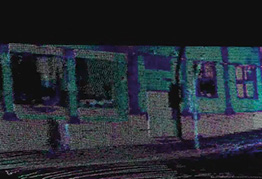
As the world progresses with advanced technology in every field, the hunt for safe and smart technology in transportation is also gaining demand. Among all the cutting-edge technology, the Imaging LIDAR stands out among all the innovations. Imaging LIDARis the path towards smart autonomous vehicles and smart infrastructure.
LIDAR technology emits laser light to create high-resolution 3D environmental maps. The laser pulses take time to reach back after hitting an object. This time measures the distance between the object and the vehicle. The high-resolution images created through LIDAR Imaging give proper details and accuracy. It not only helps with safe driving but analyzes the current environment and helps in creating better surroundings for society.
Let’s get into the deeper meaning of the importance of LIDAR in smart world for drawing a line between success and failure –
- Autonomous Vehicles (AVs)
AVs rely on various sensors that help drivers to navigate and make real-time decisions. Among these Imaging lidar is the most important. It provides detailed and precise details of objects in the path, including its distances and geometries. It is helpful during unpredictable weather conditions like hailstorms, fog, thunder lightning, and snowfall. LIDAR also provides a detailed map of the surroundings, when low light at night, or a poor signal obstructs your GPS.
For example, LIDAR imaging can identify a pedestrian or a cyclist from a distance and identify small objects like an animal or a paper bag and signal you about the obstruction. Such detections help in making the right decision in real-time. Who doesn’t love a safe journey?
- Smart Infrastructure
LIDAR imaging is also making a remarkable place in the smart infrastructure. The world is trying to get better by integrating smart technologies into its infrastructure. By providing detailed 3D maps of the environment, LIDAR helps in the development of various aspects like traffic management, urban planning, and public safety.
For example, LIDAR can manage real-time traffic images. -It also helps in adjusting the circulatory timings which further reduces congestion. It can communicate with the infrastructure. During emergencies and accidents, LIDAR images help provide faster real-time data which helps in immediate solutions and avoiding further potential hazards.
Imaging LIDAR also provides topographical data which is required to create efficient drainage systems, tunnels, and development of the areas. The 3D image created through the imaging helps architects, engineers, and planners to visualize the project and prepare a good and better layout.
The Road Ahead
The application of LIDAR imaging will expand with time. The sensor is already being used with AI and Machine learning and this will increase in the future. Moreover, with LIDAR the world is not only seeing a better future but also creating it. The power of Imaging LIDAR will play an important role in shaping the city and transportation system. If you’re planning to buy a LIDAR camera for your vehicle, choose it from a reliable brand.